 LINKED PAPER
Road exposure and the detectability of birds in field surveys. Cooke, S.C., Balmford, A., Johnston, A., Massimino, D., Newson, S.E. & Donald, P.F. 2019. IBIS. DOI: 10.1111/ibi.12787. VIEW
At the beginning of my PhD, I set out with one big question: how do roads affect bird populations in Great Britain? After a few months of trying to climb the steep learning curve required to begin even thinking about such a question, I had a rough plan in place. My supervisors and I divided the project up, with the first part being an assessment of the spatial correlation between road exposure (calculated using the density, distance and traffic levels of roads within a 5-km buffer of each site) and bird abundance, whilst accounting for other factors (e.g. agricultural yield (Donald et al. 2006) thought to affect bird populations.
To undertake this analysis, we obviously needed a clear, robust, response variable of bird abundance. Fortunately, the BTO, in collaboration with RSPB and JNCC, have been collecting bird abundance data across Britain for the past 25 years, in the form of the UK Breeding Bird Survey. For this, volunteers are allocated a 1-km square, across which they walk two 1-km transects, divided into five 200-m transect sections, twice a year during the breeding season. They record every bird they see or hear, along with the estimated distance of that bird from the transect. As surveyors are unlikely to detect every bird around the transect, these data are then analysed using distance sampling. This method allows estimation of the detectability of each species around each transect section, independent of the number of birds present (Buckland et al. 2004; Harris et al. 2018). The raw bird counts can then be corrected accordingly, to produce estimates of bird abundance.
There are several factors known to affect detectability of birds in these surveys, particularly the timing of the survey and habitat. For the latter, it is easy to imagine that in dense woodland, fewer species may be detected further away, compared to in a field, for example, due to the visual obstruction of the trees. Thinking about the context of our work, we considered that, if we were to find a link between road exposure and bird abundance, we needed to be able to say that this was because of abundance changes around roads rather than detectability changes. So, once we had processed all the road and other variable data necessary for our planned spatial analysis of birds versus roads, we ran the distance sampling models to estimate detectability of each species, with road exposure at each transect section incorporated as a covariate.
Of the 51 species we analysed, the detectabilities of 36 were significantly associated with road exposure. These associations were a mix of negative and positive, though predominantly the former. Across all species, from the minimum to maximum road exposure recorded for each, detectability decreased by a mean of 36% and increased by a mean of 52%. Associations were strongest in species with small body masses and those more likely to be detected using aural, as opposed to visual, cues.
Although this study was purely correlative, there are several reasons as to why road exposure might affect detectability. Vehicle noise could reduce the ability of surveyors to hear birds (as has been shown for gas and oil infrastructure noise (e.g. Koper et al. 2016)) or adaptations by birds to be heard over the traffic could make them easier to hear. Birds closer to roads may be warier due to collision risk, or reduced ability to detect predators, and so be more difficult to detect, or they may use the road surface for grit or roadside powerlines for perches, where they may be easier to see than among vegetation.
Our results led us to recommend that future studies investigating the impacts of roads on birds account for the potential impacts of road exposure on detectability. Other studies involving surveys of birds, and possibly other taxa as well, in areas exposed to roads should also consider this, to avoid bias in abundance estimates. This is of particular importance in countries with dense road networks such as Britain, which has 80% of its land area within 1 km of a road. We recommended using the method of kernel density estimation to calculate road exposure, as opposed to, for example, a measure of road noise, in order to account better for a wide range of impact mechanisms.
With thanks to my supervisors and co-authors: Andrew Balmford; Paul F. Donald; Alison Johnston; Dario Massimino; and Stuart E. Newson.
Nominate this article for a BOU Science Communication Award.
References
Buckland, S.T., Anderson, D.R., Burnham, K.P., Laake, J.L., Borchers, D.L. & Thomas, L. 2004. Advanced Distance Sampling: Estimating Abundance of Biological Populations. Oxford University 434 Press, Oxford, UK.
Donald, P.F., Sanderson, F.J., Burfield, I.J. & van Bommel, F.P.J. 2006. Further evidence of continent-wide impacts of agricultural intensification on European farmland birds, 1990–2000. Agriculture, Ecosystems & Environment 116: 189–196. VIEW
Harris, S.J., Massimino, D., Gillings, S., Eaton, M.A., Noble, D.G., Balmer, D.E., Procter, D., Pearce-Higgins, J.W. & Woodcock, P. 2018. The Breeding Bird Survey 2017. BTO Research Report 706. British Trust for Ornithology, Thetford. VIEW
Koper, N., Leston, L., Baker, T.M., Curry, C. & Rosa, P. 2016. Effects of ambient noise on detectability and localization of avian songs and tones by observers in grasslands. Ecol. Evol. 6: 245–255. VIEW

Image credit
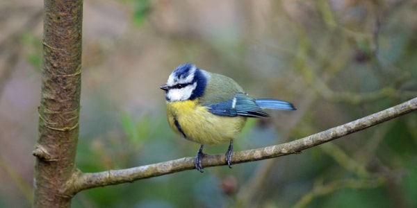
Featured image: Eurasian Blue Tit, Cyanistes caeruleus © Sophia Cooke